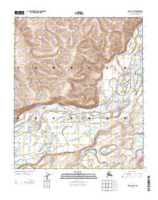
2013 Map of Umiat B-3 NW
USGS Topo · Published 2013About this map
The Colville River dominates this Arctic landscape, carving a wide path through the North Slope terrain. The river is flanked by significant geological markers, most notably Shivugak Bluff to the west and Uluksrak Bluff at the northeastern bend. These bluffs represent distinctive elevation gains in an otherwise complex network of braided river channels and alluvial deposits. The survey reflects the remote character of this region within the North Slope Borough, where the absence of roads or permanent settlements highlights the reliance on natural waterways for navigation and geography. The mapping of the township and range lines, such as the intersection of T 2 N and R 1 E, provides the primary structural framework for this uninhabited expanse of the Alaskan wilderness.
Find a feature on this map
7 named features on this map. Tap any name to fly to it.
Don’t see what you’re looking for? This feature index may not catch every label — zoom into the map to look around manually.
Map Details
Editions of this 2013 Umiat B-3 NW Map
This is the sole edition of this map. No revisions or reprints were ever made.
Other maps of this area

1952 · Umiat
USGS Topo · 1:250,000

1955 · Umiat B-4
USGS Topo · 1:63,360

1955 · Umiat C-4
USGS Topo · 1:63,360

1955 · Umiat C-3
USGS Topo · 1:63,360

1955 · Umiat B-3
USGS Topo · 1:63,360

1956 · Umiat
USGS Topo · 1:250,000

1964 · Umiat
USGS Topo · 1:250,000
2013 · Umiat C-4 SE
USGS Topo · 1:25,000
2013 · Umiat C-3 SE
USGS Topo · 1:25,000
2013 · Umiat B-3 NE
USGS Topo · 1:25,000