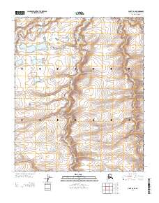
2013 Map of Umiat C-4 SE
USGS Topo · Published 2013About this map
The Kogosukruk River snakes through the northern reaches of this North Slope landscape, marking a terrain defined by subtle elevation shifts and Arctic water systems. In the northwestern corner, Dogbone Lake sits as a prominent landmark among several unnamed ponds, its distinct shape providing a clear reference point in an otherwise uniform topography. The survey effectively tracks the winding path of Henry Cr as it drains northward through the central and southern portions of the quadrangle. This area is characterized by the intersection of the Public Land Survey System lines, specifically where the boundary between Range 1 West and Range 1 East meets the division of Township 3 North and Township 2 North. The map captures the quiet isolation of the Alaskan tundra prior to modern industrial expansion in this specific sector, offering a precise look at the natural drainage patterns and hydrological features of the region.
Find a feature on this map
5 named features on this map. Tap any name to fly to it.
Don’t see what you’re looking for? This feature index may not catch every label — zoom into the map to look around manually.
Map Details
Editions of this 2013 Umiat C-4 SE Map
This is the sole edition of this map. No revisions or reprints were ever made.
Other maps of this area

1952 · Umiat
USGS Topo · 1:250,000

1955 · Umiat B-4
USGS Topo · 1:63,360

1955 · Umiat C-4
USGS Topo · 1:63,360

1955 · Umiat C-3
USGS Topo · 1:63,360

1955 · Umiat B-3
USGS Topo · 1:63,360

1956 · Umiat
USGS Topo · 1:250,000

1964 · Umiat
USGS Topo · 1:250,000
2013 · Umiat C-4 NW
USGS Topo · 1:25,000
2013 · Umiat C-3 SW
USGS Topo · 1:25,000
2013 · Umiat B-3 NW
USGS Topo · 1:25,000