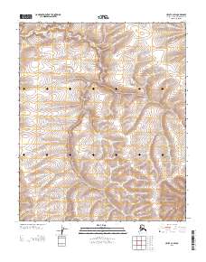
2013 Map of Umiat C-3 SW
USGS Topo · Published 2013About this map
The interior of the North Slope Borough, Alaska, presents a rhythmic landscape of ridgelines and drainage basins within the T 3 N T 2 N and R 1 E R 2 E townships. This 2013 survey reveals the intricate topography of the Arctic tundra, where elevation contours and water-carved valleys define the physical layout. Unlike more populated regions, the map lacks named settlements or developed infrastructure, focusing instead on the precise delineation of the Public Land Survey System boundaries, such as the transition to R 2 E R 3 E. The resulting data provides a foundational look at the undeveloped terrain as it appeared in the early 21st century.
Find a feature on this map
3 named features on this map. Tap any name to fly to it.
Don’t see what you’re looking for? This feature index may not catch every label — zoom into the map to look around manually.
Map Details
Editions of this 2013 Umiat C-3 SW Map
This is the sole edition of this map. No revisions or reprints were ever made.
Other maps of this area

1952 · Umiat
USGS Topo · 1:250,000

1955 · Umiat B-4
USGS Topo · 1:63,360

1955 · Umiat C-4
USGS Topo · 1:63,360

1955 · Umiat C-3
USGS Topo · 1:63,360

1955 · Umiat B-3
USGS Topo · 1:63,360

1956 · Umiat
USGS Topo · 1:250,000

1964 · Umiat
USGS Topo · 1:250,000
2013 · Umiat C-4 SE
USGS Topo · 1:25,000
2013 · Umiat C-3 SE
USGS Topo · 1:25,000
2013 · Umiat B-3 NE
USGS Topo · 1:25,000