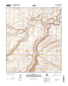
2013 Map of Umiat C-4 SW
USGS Topo · Published 2013About this map
Kogosukruk River defines the drainage of this Arctic landscape on the North Slope, weaving through a complex network of seasonal lakes and wetlands. The river's primary channel and the Br of Kogosukruk River demonstrate the characteristic meandering patterns of the region's permafrost-influenced hydrology. While devoid of named settlements or infrastructure, the map reveals the intricate topography of the tundra, where subtle elevation changes of only a few feet dictate the location of water bodies and drainage paths across the R 2 W and R 1 W township lines. This 2013 survey serves as a precise baseline for the shifting hydrography of the Alaskan interior, documenting the specific configuration of the river branches before the influence of seasonal thaw and erosion further alters their course.
Find a feature on this map
4 named features on this map. Tap any name to fly to it.
Don’t see what you’re looking for? This feature index may not catch every label — zoom into the map to look around manually.
Map Details
Editions of this 2013 Umiat C-4 SW Map
This is the sole edition of this map. No revisions or reprints were ever made.
Other maps of this area

1952 · Umiat
USGS Topo · 1:250,000

1955 · Umiat B-4
USGS Topo · 1:63,360

1955 · Umiat C-4
USGS Topo · 1:63,360

1955 · Umiat C-5
USGS Topo · 1:63,360

1955 · Umiat B-5
USGS Topo · 1:63,360

1956 · Umiat
USGS Topo · 1:250,000

1964 · Umiat
USGS Topo · 1:250,000
2013 · Umiat C-4 SE
USGS Topo · 1:25,000
2013 · Umiat C-4 NW
USGS Topo · 1:25,000
2013 · Umiat C-4 NE
USGS Topo · 1:25,000