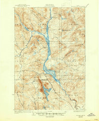
1935 Map of Umsaskis Lake
USGS Topo · Published 1947About this map
Umsaskis Lake and Long Lake dominate this deep-woods landscape within the Allagash wilderness, showing the infrastructure of the early 20th-century timber industry. The map documents a network of remote outposts like the American Realty Depot Camp and Blanchette Camp, linked by primitive routes such as the Tote Road and Realty Road. A Ferry crossing at the southern end of Long Lake and the Long Lake Dam at its northern outlet indicate how the waterways were managed for log driving and transport.
Find a feature on this map
57 named features on this map. Tap any name to fly to it.
Don’t see what you’re looking for? This feature index may not catch every label — zoom into the map to look around manually.
Map Details
Editions of this 1935 Umsaskis Lake Map
3 editions found
Other maps of this area

1932 · Umsaskis Lake
USGS Topo · 1:48,000

1932 · Musquacook Lakes
USGS Topo · 1:48,000

1932 · Allagash Falls
USGS Topo · 1:48,000

1935 · Umsaskis Lake
USGS Topo · 1:62,500

1935 · Musquacook Lakes
USGS Topo · 1:62,500

1935 · Allagash Falls
USGS Topo · 1:62,500

1954 · Spider Lake
USGS Topo · 1:62,500

1954 · Churchill Lake
USGS Topo · 1:62,500

1954 · Allagash Lake
USGS Topo · 1:62,500

1954 · Presque Isle
USGS Topo · 1:250,000