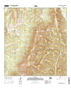
2016 Map of Unalakleet A-3 SE
USGS Topo · Published 2016About this map
The Nulato Hills dominate this portion of the Alaskan interior, providing a window into the land's topographical character in the early twenty-first century. This section of the range is characterized by significant elevation changes, with the Yellow River cutting through the northwestern corner. The drainage patterns of the region are further defined by the course of Grayling Cr, which winds through the eastern sections of the quadrangle. As a modern study, the map utilizes data from the Alaska Dept. of Transportation and the FWS National Wetlands Inventory to detail a landscape where human infrastructure is largely absent, focusing instead on the hydrography and terrain of the Yukon-Koyukuk region.
Find a feature on this map
9 named features on this map. Tap any name to fly to it.
Don’t see what you’re looking for? This feature index may not catch every label — zoom into the map to look around manually.
Map Details
Editions of this 2016 Unalakleet A-3 SE Map
This is the sole edition of this map. No revisions or reprints were ever made.
Other maps of this area

1951 · Unalakleet
USGS Topo · 1:250,000

1951 · Holy Cross
USGS Topo · 1:250,000

1952 · Unalakleet A-2
USGS Topo · 1:63,360

1952 · Unalakleet A-3
USGS Topo · 1:63,360

1952 · Holy Cross D-2
USGS Topo · 1:63,360

1952 · Holy Cross D-3
USGS Topo · 1:63,360

1952 · Unalakleet
USGS Topo · 1:250,000

1952 · Holy Cross
USGS Topo · 1:250,000

1964 · Unalakleet
USGS Topo · 1:250,000
2015 · Unalakleet A-3 NW
USGS Topo · 1:25,000