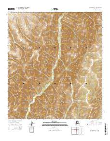
2015 Map of Unalakleet C-4 NE
USGS Topo · Published 2015About this map
Nulato Hills dominate this portion of the Alaskan interior, where the topography is defined by a dense network of drainages and ridgelines. The South River serves as the primary hydrological artery, winding through the center of the sheet and collecting various tributaries that carve deep into the surrounding heights. Several of these streams, such as Summer Camp Cr and Coal Mine Cr, carry names that hint at the seasonal subsistence and resource extraction activities historically common in this region of Nome. The landscape is marked by steep elevation changes, with the hills forming a complex series of valleys for Jesse Cr and Cascade Cr. This map represents the raw physical geography of the Alaskan wilderness before the encroachment of modern infrastructure, preserving the original hydrographic patterns and land divisions of the public land survey system.
Find a feature on this map
47 named features on this map. Tap any name to fly to it.
Don’t see what you’re looking for? This feature index may not catch every label — zoom into the map to look around manually.
Map Details
Editions of this 2015 Unalakleet C-4 NE Map
This is the sole edition of this map. No revisions or reprints were ever made.
Other maps of this area

1950 · Unalakleet D-3
USGS Topo · 1:63,360

1950 · Unalakleet D-4
USGS Topo · 1:63,360

1951 · Unalakleet
USGS Topo · 1:250,000

1952 · Unalakleet C-3
USGS Topo · 1:63,360

1952 · Unalakleet C-4
USGS Topo · 1:63,360

1952 · Unalakleet
USGS Topo · 1:250,000

1964 · Unalakleet
USGS Topo · 1:250,000
2015 · Unalakleet C-4 SE
USGS Topo · 1:25,000
2015 · Unalakleet D-4 SE
USGS Topo · 1:25,000
2015 · Unalakleet C-3 SW
USGS Topo · 1:25,000