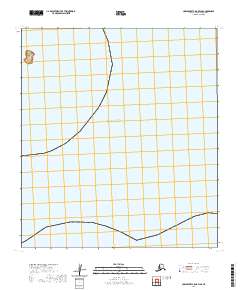
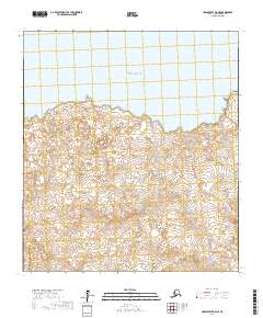
2020 Map of Unalakleet C-5 OE W SE
USGS Topo · Published 2020About this map
Norton Sound dominates this remote coastal landscape, where the waters of the Bering Sea meet the western edge of the Nome Census Area. The map highlights the isolated Egg Island just off the shoreline, a small but distinct landform in an area otherwise defined by vast aquatic expanse. This 2020 survey documents the precise coastal boundaries and township divisions, including t22s r16w and t23s r16w, which structure the public land survey system in this maritime environment. The lack of terrestrial infrastructure or settlements underscores the wilderness character of the region, focusing instead on the intersection of marine geography and formal land management.
Find a feature on this map
5 named features on this map. Tap any name to fly to it.
Don’t see what you’re looking for? This feature index may not catch every label — zoom into the map to look around manually.
Map Details
Editions of this 2020 Unalakleet C-5 OE W SE Map
This is the sole edition of this map. No revisions or reprints were ever made.
Other maps of this area

1951 · Unalakleet
USGS Topo · 1:250,000

1952 · Unalakleet B-6
USGS Topo · 1:63,360

1952 · Unalakleet B-5
USGS Topo · 1:63,360
1952 · Unalakleet C-5
USGS Topo · 1:63,360

1952 · Unalakleet
USGS Topo · 1:250,000

1964 · Unalakleet
USGS Topo · 1:250,000
2017 · Unalakleet B-5 NW
USGS Topo · 1:25,000
2017 · Unalakleet B-6 NW
USGS Topo · 1:25,000
2017 · Unalakleet B-6 NE
USGS Topo · 1:25,000