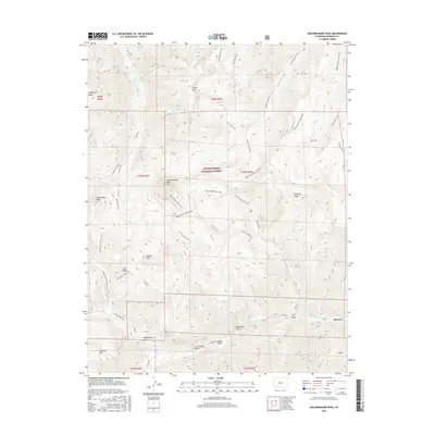
2016 Map of Uncompahgre Peak
USGS Topo · Published 2016About this map
Uncompahgre Peak dominates this high-altitude landscape in the Uncompahgre National Forest, where steep ridgelines and deep drainages define the alpine terrain. To the south, the settlement of Henson lies along Henson Cr, a corridor marked by industrial history and mineral exploration. The presence of Lee Smelter Gulch, Copper Gulch, and the Iron Beds suggests a legacy of prospecting and mining activity concentrated near the water's edge. High peaks like Silver Mtn, Matterhorn Peak, and Sunshine Mtn surround the central mass, connected by an extensive network of pack trails and stock driveways. The drainage patterns of the Little Cimarron River and Big Blue Cr carve northward through the forest, while routes like the Ridge Stock Driveway Trail and Uncompahgre Peak Trail provide access to the remote interior of this Hinsdale County wilderness.
Find a feature on this map
46 named features on this map. Tap any name to fly to it.
Don’t see what you’re looking for? This feature index may not catch every label — zoom into the map to look around manually.
Map Details
Editions of this 2016 Uncompahgre Peak Map
This is the sole edition of this map. No revisions or reprints were ever made.
Other maps of this area

1897 · Silverton
USGS Topo · 1:62,500

1901 · Silverton
USGS Topo · 1:62,500

1902 · Silverton
USGS Topo · 1:62,500

1902 · Ouray
USGS Topo · 1:62,500

1903 · Lake City
USGS Topo · 1:62,500

1904 · Ouray
USGS Topo · 1:62,500

1905 · Lake City
USGS Topo · 1:62,500

1905 · San Cristobal
USGS Topo · 1:125,000

1907 · San Cristobal
USGS Topo · 1:125,000

1908 · Uncompahgre
USGS Topo · 1:125,000