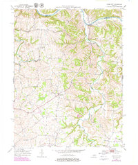
1952 Map of Union City
USGS Topo · Published 1979About this map
The Kentucky River carves the northern border of this Madison County landscape, defining the boundary with Clark County. The terrain is dominated by the winding path of Muddy Creek, which flows past the small community of Doylesville and multiple river-bend crossings. Further south, the settlement of Union City serves as a central hub for the surrounding agricultural uplands.
Find a feature on this map
16 named features on this map. Tap any name to fly to it.
Don’t see what you’re looking for? This feature index may not catch every label — zoom into the map to look around manually.
Map Details
Editions of this 1952 Union City Map
4 editions found
Other maps of this area

1892 · Richmond
USGS Topo · 1:125,000

1897 · Richmond
USGS Topo · 1:125,000

1952 · Union City
USGS Topo · 1:24,000

1952 · Palmer
USGS Topo · 1:24,000

1952 · Ford
USGS Topo · 1:24,000

1952 · Winchester
USGS Topo · 1:24,000

1952 · Richmond North
USGS Topo · 1:24,000

1952 · Panola
USGS Topo · 1:24,000
1952 · Hedges
USGS Topo · 1:24,000

1952 · Moberly
USGS Topo · 1:24,000