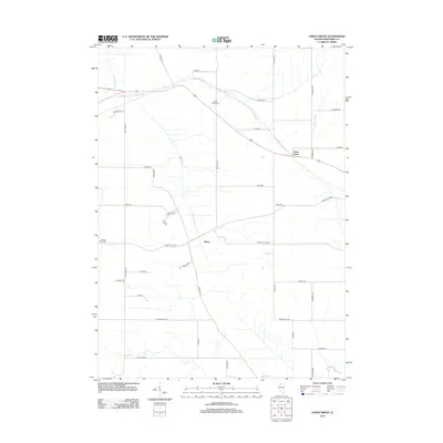
2012 Map of Union Grove
USGS Topo · Published 2012About this map
The unincorporated community of Union Grove sits at the northern edge of this Whiteside County landscape, defined by a grid of rural roads and an intricate network of waterways. Cattail Creek and the Cattail Slough drain the western portion of the terrain, while Spring Brook meanders through the central and eastern sections. These riparian corridors dictated the placement of early farmsteads and rural infrastructure during the region's development. Local history is anchored by the Cotton Wood Cem and Garden Plain Cem, which provide essential points of reference for genealogical research. The small settlement of Oliver marks a distinct point along the lower drainage of Cattail Cr, illustrating the distribution of tiny rural hamlets that once served the agricultural community between larger towns.
Find a feature on this map
40 named features on this map. Tap any name to fly to it.
Don’t see what you’re looking for? This feature index may not catch every label — zoom into the map to look around manually.
Map Details
Editions of this 2012 Union Grove Map
This is the sole edition of this map. No revisions or reprints were ever made.
Other maps of this area

1891 · Clinton
USGS Topo · 1:62,500

1894 · Clinton
USGS Topo · 1:62,500

1899 · Clinton
USGS Topo · 1:125,000

1932 · Prophetstown
USGS Topo · 1:48,000

1934 · Morrison
USGS Topo · 1:48,000

1936 · Prophetstown
USGS Topo · 1:62,500

1940 · Morrison
USGS Topo · 1:62,500

1952 · Erie
USGS Topo · 1:62,500

1952 · Clinton
USGS Topo · 1:62,500
1953 · Clinton
USGS Topo · 1:24,000