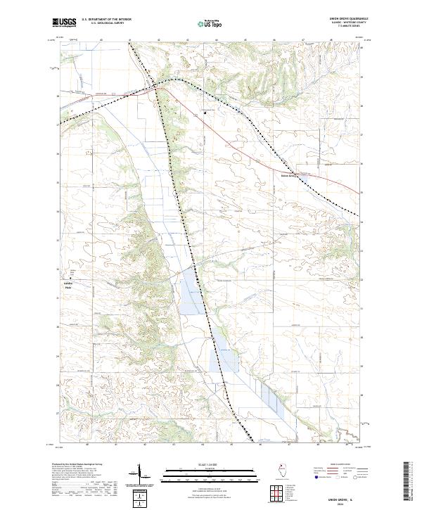
2024 Map of Union Grove
USGS Topo · Published 2024About this map
Union Grove and Garden Plain serve as the primary focal points of this Whiteside County landscape, where the agricultural grid is defined by a complex network of waterways. The terrain is notably marked by the passage of Cattail Creek and the low-lying Cattail Slough, alongside several smaller tributaries like Spring Brook, Lynn Creek, and Rock Creek. These watercourses dictate the placement of local roads and the preservation of historic sites, such as Cottonwood Cem located near the intersection of Millard Rd and Kruger Rd.
Find a feature on this map
42 named features on this map. Tap any name to fly to it.
Don’t see what you’re looking for? This feature index may not catch every label — zoom into the map to look around manually.
Map Details
Editions of this 2024 Union Grove Map
This is the sole edition of this map. No revisions or reprints were ever made.
Other maps of this area

1891 · Clinton
USGS Topo · 1:62,500

1894 · Clinton
USGS Topo · 1:62,500

1899 · Clinton
USGS Topo · 1:125,000

1932 · Prophetstown
USGS Topo · 1:48,000

1934 · Morrison
USGS Topo · 1:48,000

1936 · Prophetstown
USGS Topo · 1:62,500

1940 · Morrison
USGS Topo · 1:62,500

1952 · Erie
USGS Topo · 1:62,500

1952 · Clinton
USGS Topo · 1:62,500
1953 · Clinton
USGS Topo · 1:24,000