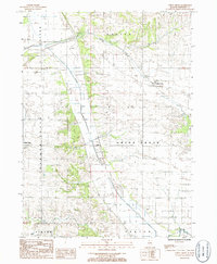
1985 Map of Union Grove
USGS Topo · Published 1986About this map
Cattail Creek meanders through this agricultural landscape, defining the low-lying drainage patterns south of Union Grove. The area reflects a mid-1980s intersection of small-town settlements and specialized land use, with Garden Plain serving as a secondary node of activity. Evidence of local industry is visible through the presence of a Peat Mine and a Gravel Pit located near the marshy corridor of the creek.
Find a feature on this map
16 named features on this map. Tap any name to fly to it.
Don’t see what you’re looking for? This feature index may not catch every label — zoom into the map to look around manually.
Map Details
Editions of this 1985 Union Grove Map
This is the sole edition of this map. No revisions or reprints were ever made.
Other maps of this area

1891 · Clinton
USGS Topo · 1:62,500

1894 · Clinton
USGS Topo · 1:62,500

1899 · Clinton
USGS Topo · 1:125,000

1932 · Prophetstown
USGS Topo · 1:48,000

1934 · Morrison
USGS Topo · 1:48,000

1936 · Prophetstown
USGS Topo · 1:62,500

1940 · Morrison
USGS Topo · 1:62,500

1952 · Erie
USGS Topo · 1:62,500

1952 · Clinton
USGS Topo · 1:62,500
1953 · Clinton
USGS Topo · 1:24,000