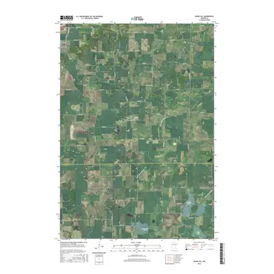
2016 Map of Union Hill
USGS Topo · Published 2016About this map
Union Hill and the surrounding agricultural landscape on the border of Scott Co and Le Sueur Co are captured here in a period of modern rural continuity. The settlement pattern is defined by family-named roads and scattered farmsteads, punctuated by historic local landmarks such as Saint Johns Cem and the Friedens Evangelical Lutheran Church Cem. To the south, the village of Heidelberg sits near the southern boundary, while the local drainage is dominated by the branches of Raven Stream.
Find a feature on this map
70 named features on this map. Tap any name to fly to it.
Don’t see what you’re looking for? This feature index may not catch every label — zoom into the map to look around manually.
Map Details
Editions of this 2016 Union Hill Map
This is the sole edition of this map. No revisions or reprints were ever made.
Other maps of this area

1953 · Saint Paul
USGS Topo · 1:250,000

1957 · Belle Plaine
USGS Topo · 1:62,500

1957 · New Prague
USGS Topo · 1:62,500

1959 · Saint Paul
USGS Topo · 1:250,000

1965 · St Thomas
USGS Topo · 1:24,000

1966 · Montgomery
USGS Topo · 1:24,000

1966 · Le Center
USGS Topo · 1:24,000
1981 · New Prague
USGS Topo · 1:24,000
1981 · Jordan West
USGS Topo · 1:24,000
1981 · Belle Plaine South
USGS Topo · 1:24,000