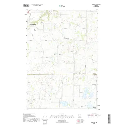
2019 Map of Union Hill
USGS Topo · Published 2019About this map
Union Hill sits at the junction of the Scott and Le Sueur county line, serving as a focal point for this rural agricultural landscape in the Minnesota River valley region. The terrain is defined by a complex network of glacial wetlands and small lakes, including Graham Lake, Renneberg Lake, and Tietz Lake, which drain into the branches of W Br Raven Stream and E Br Raven Stream. The southern edge of Belle Plaine appears in the northwest, showing modern residential expansion along roads like Kittson Blvd and Iago Blvd.
Find a feature on this map
75 named features on this map. Tap any name to fly to it.
Don’t see what you’re looking for? This feature index may not catch every label — zoom into the map to look around manually.
Map Details
Editions of this 2019 Union Hill Map
This is the sole edition of this map. No revisions or reprints were ever made.
Other maps of this area

1953 · Saint Paul
USGS Topo · 1:250,000

1957 · Belle Plaine
USGS Topo · 1:62,500

1957 · New Prague
USGS Topo · 1:62,500

1959 · Saint Paul
USGS Topo · 1:250,000

1965 · St Thomas
USGS Topo · 1:24,000

1966 · Montgomery
USGS Topo · 1:24,000

1966 · Le Center
USGS Topo · 1:24,000
1981 · New Prague
USGS Topo · 1:24,000
1981 · Jordan West
USGS Topo · 1:24,000
1981 · Belle Plaine South
USGS Topo · 1:24,000