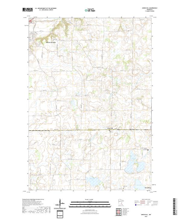
2022 Map of Union Hill
USGS Topo · Published 2022About this map
Union Hill sits at the jurisdictional boundary of Scott and Le Sueur Counties, serving as a central hub for the surrounding agricultural community. The landscape is defined by the headwaters of the Raven Stream system, with both the W Br Raven Stream and E Br Raven Stream carving through the prairie. To the north, the outskirts of Belle Plaine show the encroachment of modern development with names like Enterprise Dr and Harvest Way. Genealogical value is high across this quadrangle, as seen in the clustered sites of Saint Johns Cem and the Friedens Evangelical Lutheran Church Cem. To the south, the small settlement of Heidelberg is flanked by significant water bodies including Renneberg Lake and Tietz Lake, while the Pomeranian Cem reflects the specific immigrant heritage that shaped this region's local identity.
Find a feature on this map
74 named features on this map. Tap any name to fly to it.
Don’t see what you’re looking for? This feature index may not catch every label — zoom into the map to look around manually.
Map Details
Editions of this 2022 Union Hill Map
This is the sole edition of this map. No revisions or reprints were ever made.
Other maps of this area

1953 · Saint Paul
USGS Topo · 1:250,000

1957 · Belle Plaine
USGS Topo · 1:62,500

1957 · New Prague
USGS Topo · 1:62,500

1959 · Saint Paul
USGS Topo · 1:250,000

1965 · St Thomas
USGS Topo · 1:24,000

1966 · Montgomery
USGS Topo · 1:24,000

1966 · Le Center
USGS Topo · 1:24,000
1981 · New Prague
USGS Topo · 1:24,000
1981 · Jordan West
USGS Topo · 1:24,000
1981 · Belle Plaine South
USGS Topo · 1:24,000