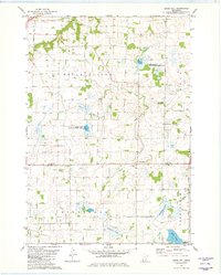
1981 Map of Union Hill
USGS Topo · Published 1982About this map
Union Hill serves as the focal point for this agrarian landscape on the border of Scott and Le Sueur counties during the early 1980s. The terrain is defined by a dense network of managed water systems, including County Ditch No 10 and County Ditch No 29, which drain the lowlands surrounding natural water bodies like Graham Lake and Renneberg Lake. This intricate drainage pattern highlights the region's transition into highly organized agricultural use, even as large tracts are preserved within the Karnitz State Wildlife Management Area and Michel State Wildlife Management Area. Local genealogy is anchored by landmarks such as St Johns Cem and Frieden Ch Cem, while the headwaters of Raven Stream wind through the township of Helena, providing a natural contrast to the grid-like county ditch system.
Find a feature on this map
22 named features on this map. Tap any name to fly to it.
Don’t see what you’re looking for? This feature index may not catch every label — zoom into the map to look around manually.
Map Details
Editions of this 1981 Union Hill Map
This is the sole edition of this map. No revisions or reprints were ever made.
Other maps of this area

1953 · Saint Paul
USGS Topo · 1:250,000

1957 · Belle Plaine
USGS Topo · 1:62,500

1957 · New Prague
USGS Topo · 1:62,500

1959 · Saint Paul
USGS Topo · 1:250,000

1965 · St Thomas
USGS Topo · 1:24,000

1966 · Montgomery
USGS Topo · 1:24,000

1966 · Le Center
USGS Topo · 1:24,000
1981 · New Prague
USGS Topo · 1:24,000
1981 · Jordan West
USGS Topo · 1:24,000
1981 · Belle Plaine South
USGS Topo · 1:24,000