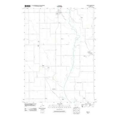
2010 Map of Union
USGS Topo · Published 2010About this map
Union and Liscomb anchor this central Iowa landscape, where the meandering Iowa River cuts through a grid of agricultural section lines and county roads. The terrain is characterized by the prominent Mormon Ridge and the waters of Mormon Lake, reflecting a region deeply tied to its geographic landmarks. Local history is exceptionally well-preserved through numerous small burial sites, including the Whitaker Family Burying Ground and the Gaer Ballard Cemetery, which provide vital touchpoints for genealogical research in Hardin and Marshall counties. Small settlements like Bangor and Stanford are connected by a network of rural routes such as Mormon Ridge Rd and Marble Rd. The presence of the Honey Creek Bridge and multiple named waterways, including Honey Creek and Mud Creek, illustrates the essential relationship between the local road system and the drainage patterns of the prairie.
Find a feature on this map
59 named features on this map. Tap any name to fly to it.
Don’t see what you’re looking for? This feature index may not catch every label — zoom into the map to look around manually.
Map Details
Editions of this 2010 Union Map
This is the sole edition of this map. No revisions or reprints were ever made.
Other maps of this area

1954 · Waterloo
USGS Topo · 1:250,000

1955 · Waterloo
USGS Topo · 1:250,000

1960 · Marshalltown
USGS Topo · 1:24,000

1960 · Marshalltown
USGS Topo · 1:62,500

1960 · Conrad West
USGS Topo · 1:24,000

1975 · State Center NW
USGS Topo · 1:24,000

1975 · State Center
USGS Topo · 1:24,000

1975 · Union
USGS Topo · 1:24,000
1975 · La Moille
USGS Topo · 1:24,000

1979 · New Providence
USGS Topo · 1:24,000