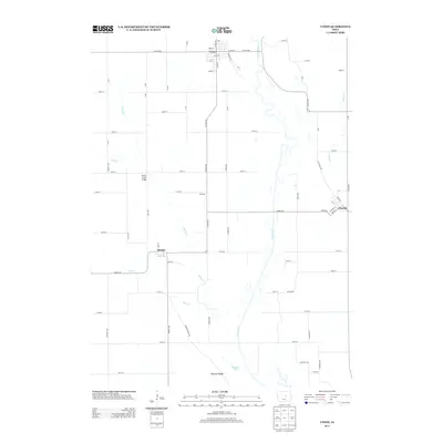
2013 Map of Union
USGS Topo · Published 2013About this map
The Iowa River meanders southward through this Hardin County landscape, shaping the development of towns like Union and Liscomb. Situated along the northern border, Union is defined by a grid of streets including Oak St, Main St, and the tellingly named Railroad St, reflecting the area's historical reliance on rail transport for agricultural commerce. Further south, the map identifies the small settlements of Bangor and Stanford, linked by a network of county highways and local roads such as Marble Rd.
Find a feature on this map
68 named features on this map. Tap any name to fly to it.
Don’t see what you’re looking for? This feature index may not catch every label — zoom into the map to look around manually.
Map Details
Editions of this 2013 Union Map
This is the sole edition of this map. No revisions or reprints were ever made.
Other maps of this area

1954 · Waterloo
USGS Topo · 1:250,000

1955 · Waterloo
USGS Topo · 1:250,000

1960 · Marshalltown
USGS Topo · 1:24,000

1960 · Marshalltown
USGS Topo · 1:62,500

1960 · Conrad West
USGS Topo · 1:24,000

1975 · State Center NW
USGS Topo · 1:24,000

1975 · State Center
USGS Topo · 1:24,000

1975 · Union
USGS Topo · 1:24,000
1975 · La Moille
USGS Topo · 1:24,000

1979 · New Providence
USGS Topo · 1:24,000