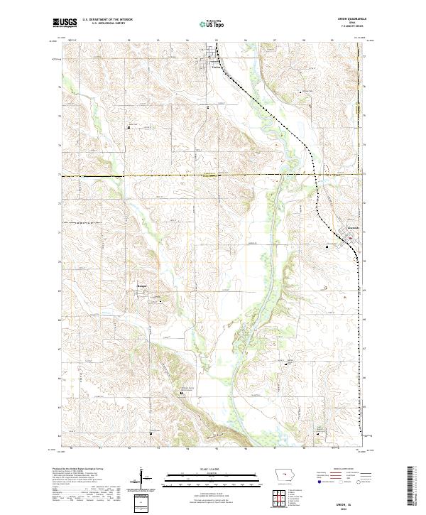
2022 Map of Union
USGS Topo · Published 2022About this map
The Iowa River meanders southward through the heart of this landscape, defining the transition between the agricultural uplands of Hardin and Marshall Counties. In the north, the town of Union sits at a historic rail junction near the river, while the settlement of Liscomb occupies the eastern rise. The map is particularly notable for its density of small, family and community burial sites that tell the story of early settlement, including the Whitaker Family Burial Ground and Bangor Friends Cem near the community of Bangor. To the south, the terrain rises into Morman Ridge, overlooking the small basin of Morman Lake. This survey of the Iowa heartland illustrates a persistent pattern of rural life, where small-town centers are connected by a grid of county roads such as Co HWY s62 and Co HWY e18, serving the dispersed farmsteads and historic cemeteries that anchor the local heritage.
Find a feature on this map
75 named features on this map. Tap any name to fly to it.
Don’t see what you’re looking for? This feature index may not catch every label — zoom into the map to look around manually.
Map Details
Editions of this 2022 Union Map
This is the sole edition of this map. No revisions or reprints were ever made.
Other maps of this area

1954 · Waterloo
USGS Topo · 1:250,000

1955 · Waterloo
USGS Topo · 1:250,000

1960 · Marshalltown
USGS Topo · 1:24,000

1960 · Marshalltown
USGS Topo · 1:62,500

1960 · Conrad West
USGS Topo · 1:24,000

1975 · State Center NW
USGS Topo · 1:24,000

1975 · State Center
USGS Topo · 1:24,000

1975 · Union
USGS Topo · 1:24,000
1975 · La Moille
USGS Topo · 1:24,000

1979 · New Providence
USGS Topo · 1:24,000