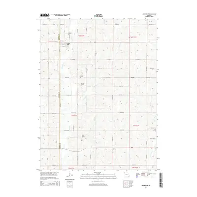
2014 Map of Union Star
USGS Topo · Published 2014About this map
Union Star sits at the intersection of Andrew and DeKalb counties, serving as a focal point for this agrarian landscape defined by the intricate drainage of Third Fork and its tributaries. The town layout is clearly marked by streets like College St and Linn St, situated just south of the Union Star Cemetery. The surrounding countryside is dotted with small rural nodes like Orchid and Oak, alongside several family and community burial grounds including Oak Grove Cemetery, Ogle Grove Cemetery, and Union Chapel Cemetery. These sites, along with waterways like Crooked Cr and Morgan Br, illustrate a long-established pattern of midwestern settlement where life and community were organized around the local creek branches and small rural church-and-cemetery hubs.
Find a feature on this map
37 named features on this map. Tap any name to fly to it.
Don’t see what you’re looking for? This feature index may not catch every label — zoom into the map to look around manually.
Map Details
Editions of this 2014 Union Star Map
This is the sole edition of this map. No revisions or reprints were ever made.
Other maps of this area

1923 · Clarksdale
USGS Topo · 1:62,500

1923 · Maysville
USGS Topo · 1:62,500

1925 · Clarksdale
USGS Topo · 1:62,500

1925 · Stanberry
USGS Topo · 1:62,500

1925 · Maysville
USGS Topo · 1:62,500

1925 · Darlington
USGS Topo · 1:62,500

1939 · Stanberry
USGS Topo · 1:62,500

1943 · Stanberry
USGS Topo · 1:62,500

1950 · Kansas City
USGS Topo · 1:250,000

1950 · Darlington
USGS Topo · 1:62,500