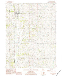
1983 Map of Union Star
USGS Topo · Published 1984About this map
Union Star serves as the primary hub of this agricultural landscape in northwestern Missouri during the early 1980s, situated near the boundary of Andrew Co De Kalb Co. The terrain is defined by the winding paths of Third Fork and Crooked Creek, which carve through the townships of Polk and Sherman. Small rural communities and named crossroads such as Orchid and Oak are scattered across the quadrangle, connected by a network of country roads.
Find a feature on this map
24 named features on this map. Tap any name to fly to it.
Don’t see what you’re looking for? This feature index may not catch every label — zoom into the map to look around manually.
Map Details
Editions of this 1983 Union Star Map
This is the sole edition of this map. No revisions or reprints were ever made.
Other maps of this area

1923 · Clarksdale
USGS Topo · 1:62,500

1923 · Maysville
USGS Topo · 1:62,500

1925 · Clarksdale
USGS Topo · 1:62,500

1925 · Stanberry
USGS Topo · 1:62,500

1925 · Maysville
USGS Topo · 1:62,500

1925 · Darlington
USGS Topo · 1:62,500

1939 · Stanberry
USGS Topo · 1:62,500

1943 · Stanberry
USGS Topo · 1:62,500

1950 · Kansas City
USGS Topo · 1:250,000

1950 · Darlington
USGS Topo · 1:62,500