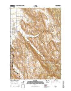
2014 Map of Union
USGS Topo · Published 2014About this map
Union sits at the edge of the Grande Ronde Valley on this 2014 topographic study, serving as a hub where mountain streams meet the agricultural flats. The town's grid is clearly defined, bordered to the east by the Union Cem and the winding course of Catherine Cr. This waterway, along with the Catherine Cr-Highline Canal, Elmer Ditch, and Prescott Ditch, illustrates a landscape deeply shaped by irrigation and water management.
Find a feature on this map
49 named features on this map. Tap any name to fly to it.
Don’t see what you’re looking for? This feature index may not catch every label — zoom into the map to look around manually.
Map Details
Editions of this 2014 Union Map
This is the sole edition of this map. No revisions or reprints were ever made.
Other maps of this area

1906 · Telocaset
USGS Topo · 1:125,000

1955 · Grangeville
USGS Topo · 1:250,000

1959 · Grangeville
USGS Topo · 1:250,000

1965 · Conley
USGS Topo · 1:24,000

1965 · Union
USGS Topo · 1:24,000

1965 · Medical Springs
USGS Topo · 1:24,000

1965 · Cove
USGS Topo · 1:24,000
1965 · North Powder
USGS Topo · 1:24,000

1965 · Little Catherine Creek
USGS Topo · 1:24,000
1965 · Telocaset
USGS Topo · 1:24,000