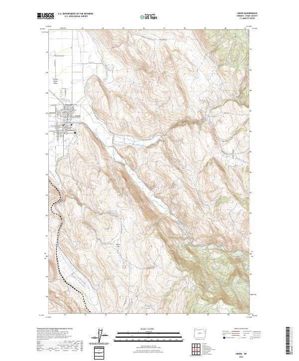
2023 Map of Union
USGS Topo · Published 2023About this map
Union serves as the primary settlement on this map, situated where the floor of the Grande Ronde Valley meets the rising terrain of the Eagle Cap foothills. This area is defined by a sophisticated water management system designed for high-altitude valley agriculture, including the Catherine Creek Highline Canal, Prescott Ditch, and Elmer Ditch. These waterways divert flows from Catherine Creek to sustain the local ranching and farming operations. Outside of the residential grid of Union, the landscape transitions into more varied topography featuring Pyles Canyon and Dry Gulch. Local landmarks such as Union Cem and several upland springs, including Wigglesworth Spring and Pursel Spring, provide specific points of interest for those studying the genealogy and rural development of this corner of Union County. The network of roads, like High Valley Rd and Ramo Flat Rd, illustrates the continued importance of access to high-elevation grazing and timber lands.
Find a feature on this map
48 named features on this map. Tap any name to fly to it.
Don’t see what you’re looking for? This feature index may not catch every label — zoom into the map to look around manually.
Map Details
Editions of this 2023 Union Map
This is the sole edition of this map. No revisions or reprints were ever made.
Other maps of this area

1906 · Telocaset
USGS Topo · 1:125,000

1955 · Grangeville
USGS Topo · 1:250,000

1959 · Grangeville
USGS Topo · 1:250,000

1965 · Conley
USGS Topo · 1:24,000

1965 · Union
USGS Topo · 1:24,000

1965 · Medical Springs
USGS Topo · 1:24,000

1965 · Cove
USGS Topo · 1:24,000
1965 · North Powder
USGS Topo · 1:24,000

1965 · Little Catherine Creek
USGS Topo · 1:24,000
1965 · Telocaset
USGS Topo · 1:24,000