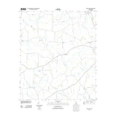
2012 Map of Union West
USGS Topo · Published 2012About this map
Neshoba and New Ireland anchor the northeastern and central portions of this landscape, which is defined by a dense network of creek-fed drainage and rural settlements. The terrain is crisscrossed by several prominent waterways, including Conehatta Cr, Sipsey Cr, and Little Sipsey Cr, which dictated the early layout of regional roads and small communities like Dover and Barfoot. For genealogists, the map identifies specific burial sites such as Beech Springs Cem, Abney Cem, and Neshoba Cem, providing precise locations for family history research. In the south, the settlement of Lucern sits near the headwaters of Roebuck Br, while the Union Municipal Airport and industrial corridors near Chunky Cr represent the modern infrastructure surrounding the western outskirts of the town. This survey illustrates how the persistent water network of Newton and Neshoba counties continues to shape the road systems and settlement pockets of east-central Mississippi.
Find a feature on this map
96 named features on this map. Tap any name to fly to it.
Don’t see what you’re looking for? This feature index may not catch every label — zoom into the map to look around manually.
Map Details
Editions of this 2012 Union West Map
This is the sole edition of this map. No revisions or reprints were ever made.
Other maps of this area

1921 · Forest
USGS Topo · 1:48,000

1922 · Forest
USGS Topo · 1:62,500

1950 · Forest
USGS Topo · 1:62,500

1952 · Forest
USGS Topo · 1:62,500

1953 · Meridian
USGS Topo · 1:250,000

1957 · Meridian
USGS Topo · 1:250,000

1965 · Meridian
USGS Topo · 1:250,000

1966 · Decatur NW
USGS Topo · 1:24,000

1966 · Decatur
USGS Topo · 1:24,000

1972 · Deemer
USGS Topo · 1:24,000