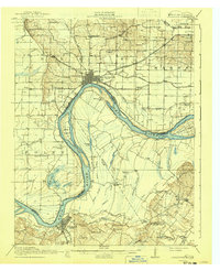
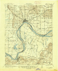
1917 Map of Uniontown
USGS Topo · Published 1941About this map
Mount Vernon and Uniontown anchor this detailed study of the riverine landscape where the Ohio River weaves through the borderlands of Kentucky and Indiana. Surveyed just before the United States entered the Great War, the sheet reveals a densely settled agricultural region defined by its reliance on water and rail. The Louisville and Nashville and Illinois Central railroads provided vital connections for riverside towns, while the intricate system of sloughs and lakes—such as Pirogue Lake, Honey Lake, and Lake Drain Slough—illustrates the complex drainage of the river bottomlands. Numerous country schools like Caney Mound School, Point School, and Doral School are scattered across the landscape, serving small farming communities like Alzey, Grafton, and Smith Mills. The presence of landmarks like Slim Island and Diamond Island highlights the ever-shifting nature of the river channel, which dictated the boundaries between Henderson, Union, and Posey counties.
Find a feature on this map
85 named features on this map. Tap any name to fly to it.
Don’t see what you’re looking for? This feature index may not catch every label — zoom into the map to look around manually.
Map Details
Editions of this 1917 Uniontown Map
6 editions found

Other maps of this area

1901 · Haubstadt
USGS Topo · 1:62,500

1903 · Haubstadt
USGS Topo · 1:62,500

1903 · New Harmony
USGS Topo · 1:62,500

1903 · Patoka
USGS Topo · 1:125,000

1905 · New Haven
USGS Topo · 1:62,500

1906 · New Haven
USGS Topo · 1:62,500

1906 · Sebree
USGS Topo · 1:62,500

1907 · Morganfield
USGS Topo · 1:62,500

1914 · Henderson
USGS Topo · 1:48,000

1916 · Shawneetown
USGS Topo · 1:62,500