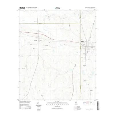
2014 Map of Uniontown West
USGS Topo · Published 2014About this map
Uniontown and Faunsdale anchor the central portion of this West Alabama survey, where the boundaries of Hale, Marengo, and Perry Counties meet. The landscape is defined by the winding paths of Cottonwood Cr and Greer Cr, which separate the agricultural highlands from the lower creek basins. Smaller settlements such as Rabbityard, Siddonsville, and Freetown reflect the historic community patterns of the Black Belt region, often centered around family burial grounds and small churches.
Find a feature on this map
74 named features on this map. Tap any name to fly to it.
Don’t see what you’re looking for? This feature index may not catch every label — zoom into the map to look around manually.
Map Details
Editions of this 2014 Uniontown West Map
This is the sole edition of this map. No revisions or reprints were ever made.
Other maps of this area

1953 · Montgomery
USGS Topo · 1:250,000

1956 · Montgomery
USGS Topo · 1:250,000

1957 · Montgomery
USGS Topo · 1:250,000

1968 · Thomaston East
USGS Topo · 1:24,000

1968 · Uniontown West
USGS Topo · 1:24,000

1968 · Uniontown East
USGS Topo · 1:24,000

1968 · Thomaston West
USGS Topo · 1:24,000

1968 · Gallion
USGS Topo · 1:24,000

1968 · Central Mills
USGS Topo · 1:24,000

1979 · Scott Station
USGS Topo · 1:24,000