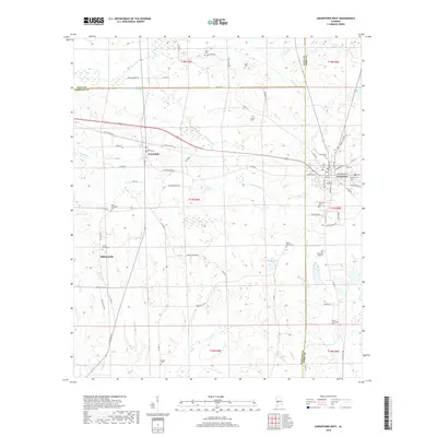
2018 Map of Uniontown West
USGS Topo · Published 2018About this map
Uniontown and Faunsdale anchor this landscape at the intersection of Marengo and Perry counties, reflecting the deep-rooted settlement patterns of Alabama's Black Belt. The topography is defined by the drainage basins of Cottonwood Cr and Greer Cr, with numerous small water bodies like Lake Roseland and Cottrell Lake punctuating the rural terrain. The density of historic burial sites, including Rosemount Cem, Holy Cross Cem, and Saint Michaels Cem, provides a significant record for genealogical research in these long-established communities. Modern infrastructure follows historical paths, notably with AL Highway 25 and Old US Hwy 80 cutting through the agricultural reaches near Siddonsville. Smaller family-named landmarks like Greer Cem and Jones Cem are scattered throughout the quadrangle, marking the generational presence of local residents across the townships.
Find a feature on this map
79 named features on this map. Tap any name to fly to it.
Don’t see what you’re looking for? This feature index may not catch every label — zoom into the map to look around manually.
Map Details
Editions of this 2018 Uniontown West Map
This is the sole edition of this map. No revisions or reprints were ever made.
Other maps of this area

1953 · Montgomery
USGS Topo · 1:250,000

1956 · Montgomery
USGS Topo · 1:250,000

1957 · Montgomery
USGS Topo · 1:250,000

1968 · Thomaston East
USGS Topo · 1:24,000

1968 · Uniontown West
USGS Topo · 1:24,000

1968 · Uniontown East
USGS Topo · 1:24,000

1968 · Thomaston West
USGS Topo · 1:24,000

1968 · Gallion
USGS Topo · 1:24,000

1968 · Central Mills
USGS Topo · 1:24,000

1979 · Scott Station
USGS Topo · 1:24,000