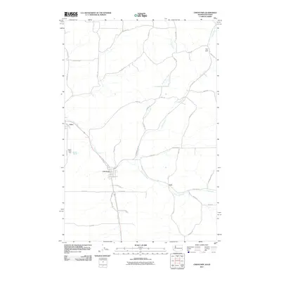
2011 Map of Uniontown
USGS Topo · Published 2011About this map
Uniontown and Colton anchor this corner of Whitman County, illustrating the agricultural and hydrological layout of the Palouse region in the early 21st century. The landscape is defined by the winding paths of Union Flat Creek and Thorn Creek, which drain a network of rolling uplands accessible via a dense grid of rural roads named for local families. These family names, such as Ron Druffel Rd, Alley Heitstum Rd, and Niehenke Rd, provide significant genealogical context for the area's land ownership history.
Find a feature on this map
46 named features on this map. Tap any name to fly to it.
Don’t see what you’re looking for? This feature index may not catch every label — zoom into the map to look around manually.
Map Details
Editions of this 2011 Uniontown Map
This is the sole edition of this map. No revisions or reprints were ever made.
Other maps of this area

1910 · Pullman
USGS Topo · 1:125,000

1945 · Clarkston
USGS Topo · 1:62,500

1948 · Clarkston
USGS Topo · 1:62,500

1955 · Pullman
USGS Topo · 1:250,000

1958 · Pullman
USGS Topo · 1:250,000

1958 · Lewiston Orchards North
USGS Topo · 1:24,000

1958 · Lewiston Orchards
USGS Topo · 1:62,500

1960 · Moscow East
USGS Topo · 1:24,000

1961 · Moscow
USGS Topo · 1:62,500

1964 · Moscow West
USGS Topo · 1:24,000