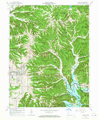
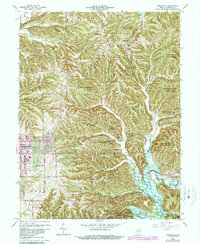
1966 Map of Unionville
USGS Topo · Published 1976About this map
Unionville and New Unionville sit at the heart of this landscape, where the wooded hills of Morgan-Monroe State Forest meet the expanding eastern edge of Bloomington. The mid-1960s terrain reflects a period of significant hydraulic transition, most notably the emergence of the Monroe Reservoir along the North Fork Salt Creek. This man-made body of water drastically reshaped the local topography, inundating valleys and creating new shorelines near settlements like Woodville Hills. On the western edge, the map documents the growth of residential and commercial hubs, including Hoosier Acres and the College Mall Shopping Center. Smaller rural landmarks remain visible across the ridges, including the Locust Grove Cem, Fleener Cem, and Phillips Sch, providing essential points of reference for genealogists tracing family roots in Benton and Perry townships.
Find a feature on this map
65 named features on this map. Tap any name to fly to it.
Don’t see what you’re looking for? This feature index may not catch every label — zoom into the map to look around manually.
Map Details
Editions of this 1966 Unionville Map
5 editions found
Other maps of this area

1908 · Bloomington
USGS Topo · 1:48,000

1910 · Bloomington
USGS Topo · 1:62,500

1942 · Franklin
USGS Topo · 1:125,000

1946 · Belmont
USGS Topo · 1:24,000

1947 · Allens Creek
USGS Topo · 1:24,000

1947 · Unionville
USGS Topo · 1:24,000

1947 · Elkinsville
USGS Topo · 1:24,000

1948 · Hindustan
USGS Topo · 1:24,000

1948 · Morgantown
USGS Topo · 1:24,000

1950 · Belmont
USGS Topo · 1:24,000