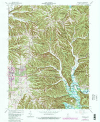
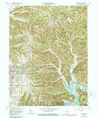
1966 Map of Unionville
USGS Topo · Published 1990About this map
Morgan-Monroe State Forest dominates much of the northeast quadrant, where steep ridges like Howard Ridge and Bender Ridge define the local topography. This 1966 revision illustrates the suburban growth of Bloomington pushing eastward into Eastern Heights and Hoosier Acres, culminating in the development of the College Mall Shopping Center. The landscape is a mix of dense forest and small rural clusters such as Unionville and Dolan.
Find a feature on this map
56 named features on this map. Tap any name to fly to it.
Don’t see what you’re looking for? This feature index may not catch every label — zoom into the map to look around manually.
Map Details
Editions of this 1966 Unionville Map
5 editions found
Other maps of this area

1908 · Bloomington
USGS Topo · 1:48,000

1910 · Bloomington
USGS Topo · 1:62,500

1942 · Franklin
USGS Topo · 1:125,000

1946 · Belmont
USGS Topo · 1:24,000

1947 · Allens Creek
USGS Topo · 1:24,000

1947 · Unionville
USGS Topo · 1:24,000

1947 · Elkinsville
USGS Topo · 1:24,000

1948 · Hindustan
USGS Topo · 1:24,000

1948 · Morgantown
USGS Topo · 1:24,000

1950 · Belmont
USGS Topo · 1:24,000