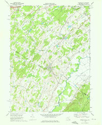
1969 Map of Unionville
USGS Topo · Published 1976About this map
The New York and New Jersey state line bisects this 1969 survey, where the valley floor of the Wallkill River meets the rising elevations of Pochuck Mountain. The landscape is defined by its colonial-era transport corridors, most notably the Minisink Turnpike and the historic Appalachian Trail, which winds through the southern portion of the quadrangle. Small agricultural hubs like Unionville and Westtown serve as focal points for a region crisscrossed by numerous rural roads, including Toad Pasture Road and Schefflers Road.
Find a feature on this map
53 named features on this map. Tap any name to fly to it.
Don’t see what you’re looking for? This feature index may not catch every label — zoom into the map to look around manually.
Map Details
Editions of this 1969 Unionville Map
Other maps of this area

1888 · Franklin
USGS Topo · 1:62,500

1891 · Greenwood Lake
USGS Topo · 1:62,500

1893 · Greenwood Lake
USGS Topo · 1:62,500

1894 · Franklin
USGS Topo · 1:62,500

1897 · Franklin
USGS Topo · 1:62,500

1903 · Franklin Furnace
USGS Topo · 1:62,500

1903 · Greenwood Lake
USGS Topo · 1:62,500

1906 · Port Jervis
USGS Topo · 1:62,500

1906 · Goshen
USGS Topo · 1:62,500

1908 · Goshen
USGS Topo · 1:62,500