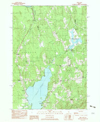
1982 Map of Unity Pond
USGS Topo · Published 1983About this map
Unity Pond dominates the southern landscape of this 1980s-era survey, its waters flanked by the settlements of Windemere and Oakwood. The surrounding terrain is a mosaic of family-named intersections and small rural clusters, including Twitchell Corner, Dodge Corner, and Mitchell Corner. These "corners" represent the historical social and transport nodes of central Maine, many centered around the township lines of Burnham, Troy, and Unity.
Find a feature on this map
42 named features on this map. Tap any name to fly to it.
Don’t see what you’re looking for? This feature index may not catch every label — zoom into the map to look around manually.
Map Details
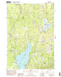
Editions of this 1982 Unity Pond Map
2 editions found
Other maps of this area

1926 · Burnham
USGS Topo · 1:62,500

1930 · Pittsfield
USGS Topo · 1:48,000

1931 · Stetson
USGS Topo · 1:48,000

1932 · Brooks
USGS Topo · 1:62,500

1932 · Pittsfield
USGS Topo · 1:62,500

1933 · Pittsfield
USGS Topo · 1:62,500

1935 · Stetson
USGS Topo · 1:62,500

1948 · Bangor
USGS Topo · 1:250,000

1955 · Pittsfield
USGS Topo · 1:62,500

1955 · Brooks
USGS Topo · 1:62,500