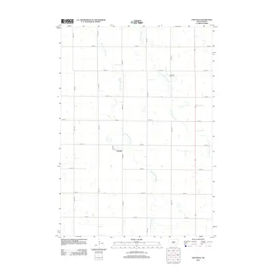
2012 Map of Unityville
USGS Topo · Published 2012About this map
Unityville serves as the central settlement point in this eastern South Dakota landscape, situated along the north-south alignment of Stark Rd. The terrain is defined by the meandering courses of the W Fork Vermillion River and the Little Vermillion River, which create a complex drainage pattern across the township. For genealogists and local historians, the map identifies significant burial sites including the Sun Prairie Baptist Cem and Olsen Cem, markers of the area's early community centers. The grid of rural roads, such as 438th Ave and 247th St, provides a clear view of the agricultural sectioning that has organized McCook County since its early settlement. This survey reveals how the local infrastructure integrates with the natural watercourses of the Vermillion river system.
Find a feature on this map
19 named features on this map. Tap any name to fly to it.
Don’t see what you’re looking for? This feature index may not catch every label — zoom into the map to look around manually.
Map Details
Editions of this 2012 Unityville Map
This is the sole edition of this map. No revisions or reprints were ever made.
Other maps of this area

1899 · Alexandria
USGS Topo · 1:125,000

1955 · Sioux Falls
USGS Topo · 1:250,000

1958 · Sioux Falls
USGS Topo · 1:250,000

1964 · Salem NE
USGS Topo · 1:24,000

1964 · Salem
USGS Topo · 1:24,000
1971 · Winfred
USGS Topo · 1:24,000
1971 · Canova East
USGS Topo · 1:24,000

1971 · Unityville
USGS Topo · 1:24,000
1971 · Winfred SE
USGS Topo · 1:24,000

1973 · Canova SE
USGS Topo · 1:24,000