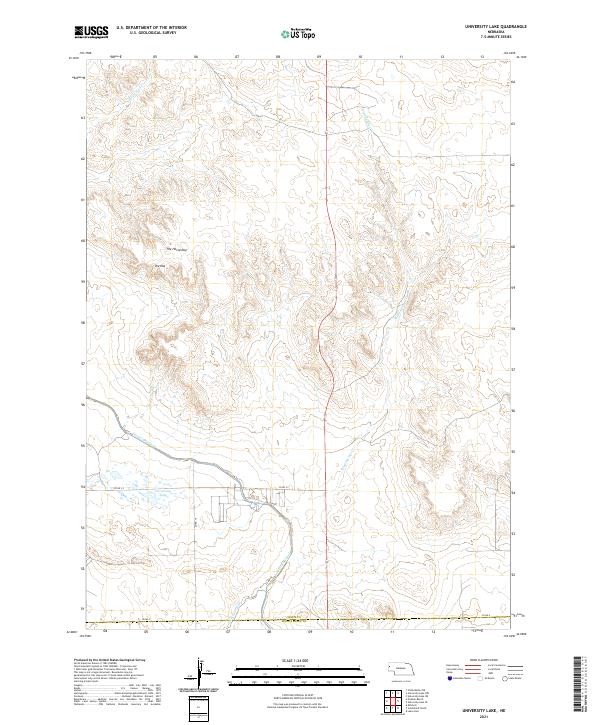
2021 Map of University Lake
USGS Topo · Published 2021About this map
The Interstate Canal and its associated waterworks, such as Lateral 21 Main, define the agricultural engineering of this western Nebraska landscape. These structures cut across the high plains of Sioux County, illustrating the essential role of irrigation in the Nebraska Panhandle. The map reveals a high-relief terrain where distinct landforms like The Horseshoe and The Hat rise above the surrounding drainage basins. Near the junction of Co RD S-C and Co RD 19, the namesake University Lake serves as a local landmark. Seasonal watercourses including Spottedtail Cr and Wind Springs Cr emphasize the arid nature of the region, where life and geography are dictated by the presence of managed water.
Find a feature on this map
18 named features on this map. Tap any name to fly to it.
Don’t see what you’re looking for? This feature index may not catch every label — zoom into the map to look around manually.
Map Details
Editions of this 2021 University Lake Map
This is the sole edition of this map. No revisions or reprints were ever made.
Other maps of this area

1898 · Scotts Bluff
USGS Topo · 1:125,000

1899 · Whistle Creek
USGS Topo · 1:125,000

1954 · Scottsbluff
USGS Topo · 1:250,000

1955 · Alliance
USGS Topo · 1:250,000

1957 · Alliance
USGS Topo · 1:250,000

1958 · Alliance
USGS Topo · 1:250,000

1958 · Scottsbluff
USGS Topo · 1:250,000

1963 · Mitchell
USGS Topo · 1:24,000

1963 · Scottsbluff North
USGS Topo · 1:24,000
1963 · Erdman Ranch
USGS Topo · 1:24,000