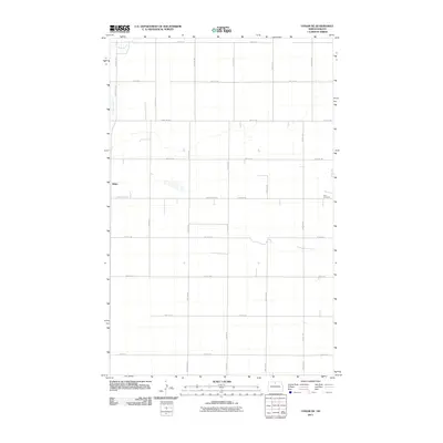
2011 Map of Upham NE
USGS Topo · Published 2011About this map
Zion Cemetery stands as a quiet focal point in the eastern portion of this Bottineau County landscape, reflecting the rural community's enduring roots. The settlement of White appears in the northwest, situated along White Spur Rd and the banks of Stone Creek. This 2011 survey captures the highly organized section-line road network typical of the Great Plains, where routes like Kramer Rd, Town Line Rd, and County Rd 20 Ne partition the land into precise agricultural blocks. The drainage of Stone Creek provides the primary break in this geometric grid, meandering through the western sections. This map is an essential resource for those tracing local family histories or the evolution of prairie transportation routes in the early 21st century.
Find a feature on this map
25 named features on this map. Tap any name to fly to it.
Don’t see what you’re looking for? This feature index may not catch every label — zoom into the map to look around manually.
Map Details
Editions of this 2011 Upham NE Map
This is the sole edition of this map. No revisions or reprints were ever made.
Other maps of this area

1949 · Kramer
USGS Topo · 1:24,000

1950 · Kramer
USGS Topo · 1:24,000

1950 · Upham SE
USGS Topo · 1:24,000

1950 · Upham
USGS Topo · 1:24,000

1950 · Willow City SW
USGS Topo · 1:24,000

1954 · Souris SW
USGS Topo · 1:24,000

1954 · Souris SE
USGS Topo · 1:24,000

1954 · Gardena
USGS Topo · 1:24,000

1954 · Minot
USGS Topo · 1:250,000
1955 · Upham NE
USGS Topo · 1:24,000