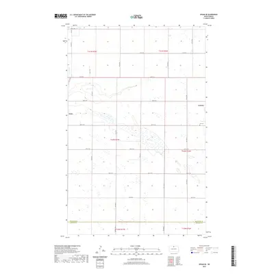
2020 Map of Upham NE
USGS Topo · Published 2020About this map
Gardena sits at the edge of this prairie landscape in northern North Dakota, where the grid of the Public Land Survey System defines the movement of people and water. The terrain is characterized by numerous small wetlands and depressions typical of the Drift Prairie, with the meandering course of Stone Cr clipping the northwest corner of the survey. To the south, the boundary between Bottineau Co and Mchenry Co bisects the region, marking a political line across an otherwise uniform agricultural expanse. Small local settlements like White and the presence of Zion Cem near the eastern edge provide anchor points for genealogical research, while a network of rural routes including White Spur Rd and Central Ave N connect these isolated locations. The map illustrates a modern era of land management where individual section lines dictate the placement of nearly every road and property boundary.
Find a feature on this map
29 named features on this map. Tap any name to fly to it.
Don’t see what you’re looking for? This feature index may not catch every label — zoom into the map to look around manually.
Map Details
Editions of this 2020 Upham NE Map
This is the sole edition of this map. No revisions or reprints were ever made.
Other maps of this area

1949 · Kramer
USGS Topo · 1:24,000

1950 · Kramer
USGS Topo · 1:24,000

1950 · Upham SE
USGS Topo · 1:24,000

1950 · Upham
USGS Topo · 1:24,000

1950 · Willow City SW
USGS Topo · 1:24,000

1954 · Souris SW
USGS Topo · 1:24,000

1954 · Souris SE
USGS Topo · 1:24,000

1954 · Gardena
USGS Topo · 1:24,000

1954 · Minot
USGS Topo · 1:250,000
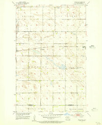
1955 · Upham NE
USGS Topo · 1:24,000