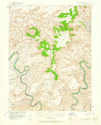
1951 Map of Upheaval Dome
USGS Topo · Published 1961About this map
The confluence of the Colorado River and the Green River defines this high-desert canyon landscape in San Juan County, mapped here just as the Atomic Energy Commission was intensifying its regional interest. The terrain is dominated by the circular structure of Upheaval Dome and the expansive plateaus of Buck Mesa and Grays Pasture. Natural water sources, critical for any human activity in this arid environment, are marked at Neck Spr, Holeman Spr, and Willow Seep. Evidence of ancient inhabitants is preserved at a Cliff Dwelling located near the river's edge. Dramatic topographical features like Junction Butte, Aztec Butte, and the Stillwater Rim illustrate the complex erosion patterns that have carved out names like Valentine Bottom and Tuxedo Bottom along the winding river corridors.
Find a feature on this map
49 named features on this map. Tap any name to fly to it.
Don’t see what you’re looking for? This feature index may not catch every label — zoom into the map to look around manually.
Map Details
Editions of this 1951 Upheaval Dome Map
3 editions found
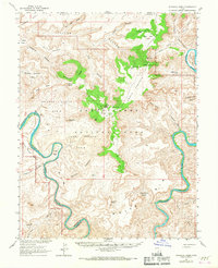
Other maps of this area

1885 · San Rafael
USGS Topo · 1:250,000

1885 · La Sal
USGS Topo · 1:250,000

1951 · The Knoll
USGS Topo · 1:62,500

1951 · Upheaval Dome
USGS Topo · 1:62,500

1952 · Tidwell 4 SE
USGS Topo · 1:24,000

1952 · Carlisle 2 SE
USGS Topo · 1:24,000

1952 · Carlisle 2 NW
USGS Topo · 1:24,000

1952 · Moab 3 SE
USGS Topo · 1:24,000

1952 · Carlisle 2 NE
USGS Topo · 1:24,000

1952 · Carlisle 2 SW
USGS Topo · 1:24,000