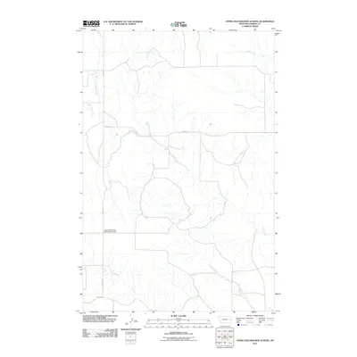
2011 Map of Upper Cracker Box School
USGS Topo · Published 2011About this map
Upper Cracker Box School (Historical) marks a site of early education and rural community center in this corner of Dawson County. The landscape is defined by the dendritic drainage patterns of Clear Creek and its tributary, North Branch Clear Creek, which carve through the plains. To the northeast, the waters of Sand Creek flow through an area otherwise dominated by the section-line grid of the local road network. The placement of Road 229, Road 238, and County Rd 15 illustrates the modern infrastructure laid over a sparsely populated ranching and farming environment, where historical landmarks like the schoolhouse remain as the primary touchstones for local heritage.
Find a feature on this map
8 named features on this map. Tap any name to fly to it.
Don’t see what you’re looking for? This feature index may not catch every label — zoom into the map to look around manually.
Map Details
Editions of this 2011 Upper Cracker Box School Map
This is the sole edition of this map. No revisions or reprints were ever made.
Other maps of this area

1909 · Glendive
USGS Topo · 1:250,000

1953 · Miles City
USGS Topo · 1:250,000

1954 · Glendive
USGS Topo · 1:250,000

1957 · Miles City
USGS Topo · 1:250,000

1957 · Glendive
USGS Topo · 1:250,000

1958 · Miles City
USGS Topo · 1:250,000

1958 · Glendive
USGS Topo · 1:250,000
1967 · Marsh
USGS Topo · 1:24,000
1967 · Fallon NE
USGS Topo · 1:24,000
1972 · Hendrickson Coulee
USGS Topo · 1:24,000