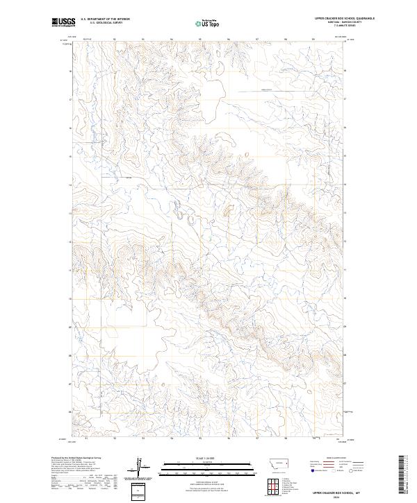
2024 Map of Upper Cracker Box School
USGS Topo · Published 2024About this map
Clear Creek and its various tributaries define the drainage patterns of this contemporary Dawson County landscape. The topographic data reveals the intricate headwaters of Cracker Box Creek and the North Fork Cracker Box Creek, carving through the high plains of eastern Montana. This is a sparse, rural area primarily organized by the Public Land Survey System, as seen in the grid boundaries of t15n r52e and t16n r53e. Human presence is marked by primitive and secondary access routes like Rd 238 and Rd 229, which thread between the ridges and stream valleys. The map provides a precise view of the local hydrology, including the North Branch Clear Creek and Sand Creek, illustrating the natural conduits that have shaped ranching and land use in this part of the state for generations.
Find a feature on this map
13 named features on this map. Tap any name to fly to it.
Don’t see what you’re looking for? This feature index may not catch every label — zoom into the map to look around manually.
Map Details
Editions of this 2024 Upper Cracker Box School Map
This is the sole edition of this map. No revisions or reprints were ever made.
Other maps of this area

1909 · Glendive
USGS Topo · 1:250,000

1953 · Miles City
USGS Topo · 1:250,000

1954 · Glendive
USGS Topo · 1:250,000

1957 · Miles City
USGS Topo · 1:250,000

1957 · Glendive
USGS Topo · 1:250,000

1958 · Miles City
USGS Topo · 1:250,000

1958 · Glendive
USGS Topo · 1:250,000

1967 · Marsh
USGS Topo · 1:24,000
1967 · Fallon NE
USGS Topo · 1:24,000

1972 · Hendrickson Coulee
USGS Topo · 1:24,000