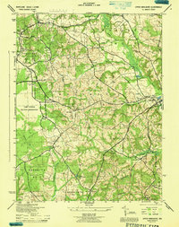
1944 Map of Upper Marlboro
USGS Topo · Published 1944About this map
The Prince George's County seat of Upper Marlboro serves as the focal point of this mid-century landscape, positioned at the convergence of Western Br and Federal Spring Branch. The map reveals a transition between rural agricultural areas and increasing government presence, notably defined by the expansive Camp Springs Military Reservation and the U S Naval Reservation to the south. Local history is deeply embedded in the terrain through family and institutional landmarks such as the Alms House near Berry Lane and numerous religious sites like St Barnabas Chapel and St Luke Church. The transport network of the time is characterized by the winding Marlboro Pike and the Crain Highway, while the presence of an Abandoned RR near Croom Station hints at the shifting logistics of the era, where former rail lines were already giving way to modern road infrastructure.
Find a feature on this map
48 named features on this map. Tap any name to fly to it.
Don’t see what you’re looking for? This feature index may not catch every label — zoom into the map to look around manually.
Map Details
Editions of this 1944 Upper Marlboro Map
This is the sole edition of this map. No revisions or reprints were ever made.
Other maps of this area

1892 · Prince Frederick
USGS Topo · 1:62,500

1892 · Brandywine
USGS Topo · 1:62,500

1892 · Owensville
USGS Topo · 1:62,500

1895 · Prince Frederick
USGS Topo · 1:62,500

1895 · Brandywine
USGS Topo · 1:62,500

1895 · Owensville
USGS Topo · 1:62,500

1899 · Patuxent
USGS Topo · 1:125,000

1900 · Washington
USGS Topo · 1:62,500

1901 · Prince Frederick
USGS Topo · 1:62,500

1905 · Owensville
USGS Topo · 1:62,500