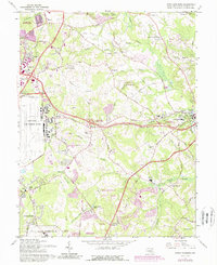
1965 Map of Upper Marlboro
USGS Topo · Published 1989About this map
Andrews Air Force Base dominates the western edge of this landscape, its expansive runways and perimeter roads like North Perimeter Road contrasting with the rural Maryland countryside to the east. The 1960s suburban expansion is evident in the purple-shaded growth of Forestville, Mellwood, and Clinton Heights, yet significant agricultural history remains preserved at the University of Maryland Tobacco Experimental Farm.
Find a feature on this map
60 named features on this map. Tap any name to fly to it.
Don’t see what you’re looking for? This feature index may not catch every label — zoom into the map to look around manually.
Map Details
Editions of this 1965 Upper Marlboro Map
5 editions found

Other maps of this area

1892 · Prince Frederick
USGS Topo · 1:62,500

1892 · Brandywine
USGS Topo · 1:62,500

1892 · Owensville
USGS Topo · 1:62,500

1895 · Prince Frederick
USGS Topo · 1:62,500

1895 · Brandywine
USGS Topo · 1:62,500

1895 · Owensville
USGS Topo · 1:62,500

1899 · Patuxent
USGS Topo · 1:125,000

1900 · Washington
USGS Topo · 1:62,500

1901 · Prince Frederick
USGS Topo · 1:62,500

1905 · Owensville
USGS Topo · 1:62,500