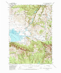
1950 Map of Upper Red Rock Lake
USGS Topo · Published 1973About this map
The Red Rock Lakes National Wildlife Refuge anchors this high-altitude landscape, protecting the waters of Upper Red Rock Lake and Swan Lake. The terrain is defined by the Continental Divide, which separates the high peaks of the Centennial Mountains from the Centennial Valley. This mid-century survey captures a ranching and early tourism economy, evidenced by several family-named operations such as Edwards Ranch and Cook Sheep Ranch, alongside the Selby Resort on the shores of Elk Lake. In the high timber of the Beaverhead National Forest, traces of resource extraction appear at the Lost Mine near Lost Mine Bench. The map illustrates a complex network of mountain passes, including Red Rock Pass and Snowshoe Pass, which served as vital connectors between the valley floor and the surrounding basins.
Find a feature on this map
64 named features on this map. Tap any name to fly to it.
Don’t see what you’re looking for? This feature index may not catch every label — zoom into the map to look around manually.
Map Details
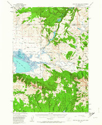
Editions of this 1950 Upper Red Rock Lake Map
3 editions found
Other maps of this area

1950 · Cliff Lake
USGS Topo · 1:62,500

1950 · Hebgen Dam
USGS Topo · 1:62,500

1950 · Lower Red Rock Lake
USGS Topo · 1:62,500

1950 · Monument Ridge
USGS Topo · 1:62,500

1950 · Upper Red Rock Lake
USGS Topo · 1:62,500

1955 · Ashton
USGS Topo · 1:250,000

1958 · Ashton
USGS Topo · 1:250,000

1960 · Ashton
USGS Topo · 1:250,000

1964 · Island Park Dam
USGS Topo · 1:24,000

1964 · Targhee Peak
USGS Topo · 1:24,000