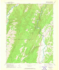
1969 Map of Upper Tract
USGS Topo · Published 1972About this map
The South Branch Potomac River and the North Fork carve through the center of this landscape, framing the prominent North Fork Mountain. In the late 1960s, these river valleys remained the primary arteries for local life, connecting small communities like Upper Tract and Mouth of Seneca. The map reveals a mountain economy shaped by the topography, where farm fields are concentrated in the narrow bottomlands while the higher elevations are preserved as part of the Monongahela National Forest. Significant landmarks such as Seneca Rocks and Eagle Rock rise over the riverbanks, while the presence of the North Fork Mtn Lookout Tower highlights the ongoing importance of forest management in this era. For those tracing local history, several rural gathering places are noted, including St Georges Ch and the Seneca Rocks Sch, alongside numerous small family Cem plots that dot the ridges and hollows.
Find a feature on this map
40 named features on this map. Tap any name to fly to it.
Don’t see what you’re looking for? This feature index may not catch every label — zoom into the map to look around manually.
Map Details
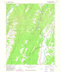
Editions of this 1969 Upper Tract Map
2 editions found
Other maps of this area

1892 · Franklin
USGS Topo · 1:125,000

1896 · Franklin
USGS Topo · 1:125,000

1920 · Petersburg
USGS Topo · 1:48,000

1920 · Onego
USGS Topo · 1:62,500

1921 · Petersburg
USGS Topo · 1:48,000

1921 · Onego
USGS Topo · 1:48,000

1922 · Onego
USGS Topo · 1:62,500

1922 · Fort Seybert
USGS Topo · 1:48,000

1922 · Petersburg
USGS Topo · 1:62,500

1922 · Circleville
USGS Topo · 1:62,500