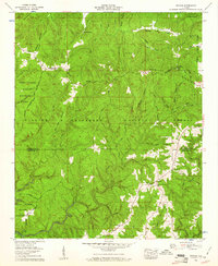
1960 Map of Upshaw
USGS Topo · Published 1961About this map
The William B Bankhead National Forest defines the rugged topography of this Lawrence and Winston County border region. Along the Tennessee Valley Divide, the landscape transitions from the high elevations of Dillashaw Mountain and Brindley Mountain down into the dense network of the Black Warrior Wildlife Management Area. The map reveals a dispersed rural settlement pattern characterized by small community centers like Upshaw, where the local social fabric is anchored by landmarks such as Penn Sch and several country churches including Lindsey Hall Ch.
Find a feature on this map
61 named features on this map. Tap any name to fly to it.
Don’t see what you’re looking for? This feature index may not catch every label — zoom into the map to look around manually.
Map Details
Editions of this 1960 Upshaw Map
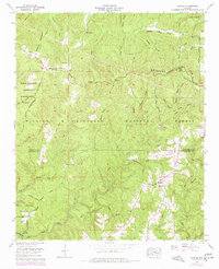
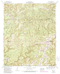
Other maps of this area

1935 · Moulton
USGS Topo · 1:24,000

1935 · Upshaw
USGS Topo · 1:24,000

1935 · Danville
USGS Topo · 1:48,000

1935 · Oakville
USGS Topo · 1:24,000

1936 · Mc Kendry
USGS Topo · 1:24,000

1936 · Moulton
USGS Topo · 1:48,000

1936 · Stroups Crossroads
USGS Topo · 1:24,000

1938 · Danville
USGS Topo · 1:62,500

1940 · Mt Hope
USGS Topo · 1:62,500

1956 · Gadsden
USGS Topo · 1:250,000