
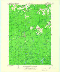
1940 Map of Upson
USGS Topo · Published 1961About this map
The Montreal River and the Potato River carve through the northwoods of Iron County, defining a landscape of timber and early industrial extractivism. Near the township of Iron Belt, the density of rail lines like the Chicago and Northwestern and the Sault Ste Marie and Minneapolis highlights the region's importance as a transportation corridor for northern Wisconsin. While towns like Montreal and Pence anchor the eastern edge, the interior is marked by isolation, containing seasonal sites such as LeClair Camp and McIver Camp tucked away near Island Lake.
Find a feature on this map
58 named features on this map. Tap any name to fly to it.
Don’t see what you’re looking for? This feature index may not catch every label — zoom into the map to look around manually.
Map Details
Editions of this 1940 Upson Map
2 editions found
Other maps of this area

1940 · Mercer
USGS Topo · 1:48,000

1940 · Butternut
USGS Topo · 1:48,000

1942 · Glidden
USGS Topo · 1:48,000

1942 · Mellen
USGS Topo · 1:48,000

1943 · Little Girls Point
USGS Topo · 1:24,000

1943 · Upson
USGS Topo · 1:48,000

1943 · Ironwood
USGS Topo · 1:48,000

1943 · Little Girl Point
USGS Topo · 1:48,000

1943 · Odanah
USGS Topo · 1:48,000

1945 · Odanah
USGS Topo · 1:48,000