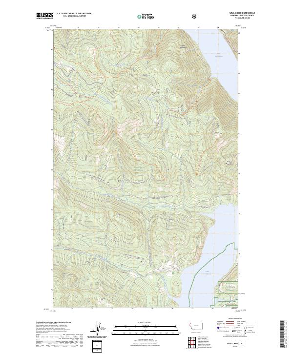
2024 Map of Ural Creek
USGS Topo · Published 2024About this map
Kootenai National Forest dominates this mountain landscape, defined by the sharp verticality of the Purcell Mountains and the eastern reach of Lake Koocanusa. The map reveals a complex network of forest development roads and primitive trails that crisscross the drainages of Ural Creek and Bristow Creek. These paths, including the High Divide Trl and Lawrence Mountain Trl, follow the natural contours of the ridges and creek bottoms, indicating a land primarily managed for timber and backcountry recreation. The presence of named peaks like Ziegler Mtn and waterways such as Giebler Creek suggests the enduring influence of early surveyors and foresters who navigated this difficult terrain before the creation of the reservoir. A series of forest roads, such as Bristow Creek Rd, provide the primary access into these deep mountain valleys.
Find a feature on this map
33 named features on this map. Tap any name to fly to it.
Don’t see what you’re looking for? This feature index may not catch every label — zoom into the map to look around manually.
Map Details
Editions of this 2024 Ural Creek Map
This is the sole edition of this map. No revisions or reprints were ever made.
Other maps of this area

1920 · Jennings
USGS Topo · 1:125,000

1935 · Thompson Lakes
USGS Topo · 1:96,000

1942 · Thompson Lakes
USGS Topo · 1:125,000

1957 · Kalispell
USGS Topo · 1:250,000

1960 · Kalispell
USGS Topo · 1:250,000

1961 · Kalispell
USGS Topo · 1:250,000

1963 · Vermiculite Mountain
USGS Topo · 1:24,000

1963 · Mc Guire Mountain
USGS Topo · 1:24,000

1963 · Banfield Mountain
USGS Topo · 1:24,000

1963 · Cripple Horse Mountain
USGS Topo · 1:24,000