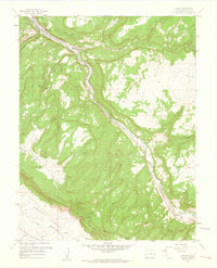
1960 Map of Uravan
USGS Topo · Published 1961About this map
Uravan sits at the northern edge of this 1960 revision, serving as the industrial hub for the extensive mining operations scattered across the surrounding mesas. The San Miguel River carves a deep path through the landscape, flanked by specialized infrastructure including tailings ponds and a gaging station. The map reveals an intense concentration of uranium and vanadium mining history, with family and claim-named sites like the Sunbeam Mine, Virgin Mine, and Bitter Creek Mines dotting the high ground of Long Park and Third Park. To the southwest, the geological transition into the Paradox Valley is marked by the drainage of East Paradox Creek. This survey captures the height of the mid-century mining boom, detailing the complex network of a truck trail and Long Park Road that connected these remote extraction sites to the processing facilities at the river's edge.
Find a feature on this map
36 named features on this map. Tap any name to fly to it.
Don’t see what you’re looking for? This feature index may not catch every label — zoom into the map to look around manually.
Map Details
Editions of this 1960 Uravan Map
4 editions found
Other maps of this area

1916 · Paradox Valley
USGS Topo · 1:125,000

1922 · Paradox Valley
USGS Topo · 1:125,000

1948 · Bull Canyon
USGS Topo · 1:24,000

1948 · Uravan
USGS Topo · 1:24,000

1948 · Naturita NW
USGS Topo · 1:24,000

1949 · Bull Canyon
USGS Topo · 1:24,000

1949 · Davis Mesa
USGS Topo · 1:24,000

1949 · Uravan
USGS Topo · 1:24,000

1949 · Naturita NW
USGS Topo · 1:24,000

1949 · Atkinson Creek
USGS Topo · 1:24,000