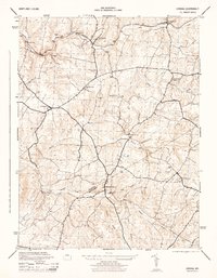
1944 Map of Urbana
USGS Topo · Published 1944About this map
The Baltimore and Ohio railroad corridor anchors the northern reach of this landscape, passing through the established community of Monrovia and the village of Ijamsville. Moving south, the terrain transitions into a patchwork of rural crossroads and stream-side settlements defined by the Frederick and Montgomery county line. The presence of a Grist Mill near Hyattstown and several named localities like Fountain Mills and Reels Mill points to an economy historically tied to the water power of Bush Creek and Bennett Creek.
Find a feature on this map
23 named features on this map. Tap any name to fly to it.
Don’t see what you’re looking for? This feature index may not catch every label — zoom into the map to look around manually.
Map Details
Editions of this 1944 Urbana Map
2 editions found
Other maps of this area

1893 · Frederick
USGS Topo · 1:125,000

1894 · Frederick
USGS Topo · 1:125,000

1908 · Rockville
USGS Topo · 1:62,500

1908 · Seneca
USGS Topo · 1:62,500

1908 · Ijamsville
USGS Topo · 1:62,500

1909 · Mount Airy
USGS Topo · 1:62,500

1909 · Ijamsville
USGS Topo · 1:62,500

1923 · Rockville
USGS Topo · 1:62,500

1942 · Frederick
USGS Topo · 1:62,500

1944 · Walkersville
USGS Topo · 1:31,680