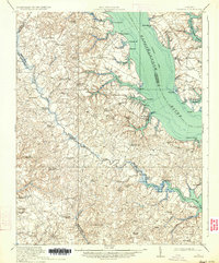
1917 Map of Urbanna
USGS Topo · Published 1934About this map
The Rappahannock River and Plankatank River define the tidewater landscape of this 1916 survey, a region where life was deeply tied to the water. A prominent Steamboat Route tracks through the center of the Rappahannock, connecting riverfront landings like Burhans Wharf and the port of Urbanna to broader trade networks. Inland, the map reveals a dense network of local schools and churches, such as Whitehouse School and St Pauls Church, which served the rural agricultural communities that peppered the peninsulas.
Find a feature on this map
85 named features on this map. Tap any name to fly to it.
Don’t see what you’re looking for? This feature index may not catch every label — zoom into the map to look around manually.
Map Details
Editions of this 1917 Urbanna Map
3 editions found
Other maps of this area

1906 · Williamsburg
USGS Topo · 1:62,500

1916 · Kilmarnock
USGS Topo · 1:48,000

1916 · Mathews
USGS Topo · 1:62,500

1917 · Heathsville
USGS Topo · 1:48,000

1917 · Urbanna
USGS Topo · 1:62,500

1917 · Morattico
USGS Topo · 1:62,500

1917 · Kilmarnock
USGS Topo · 1:62,500

1917 · Mathews
USGS Topo · 1:62,500

1917 · Toano
USGS Topo · 1:62,500

1918 · Toano
USGS Topo · 1:62,500